Wallowa River Loop Backpacking Guide
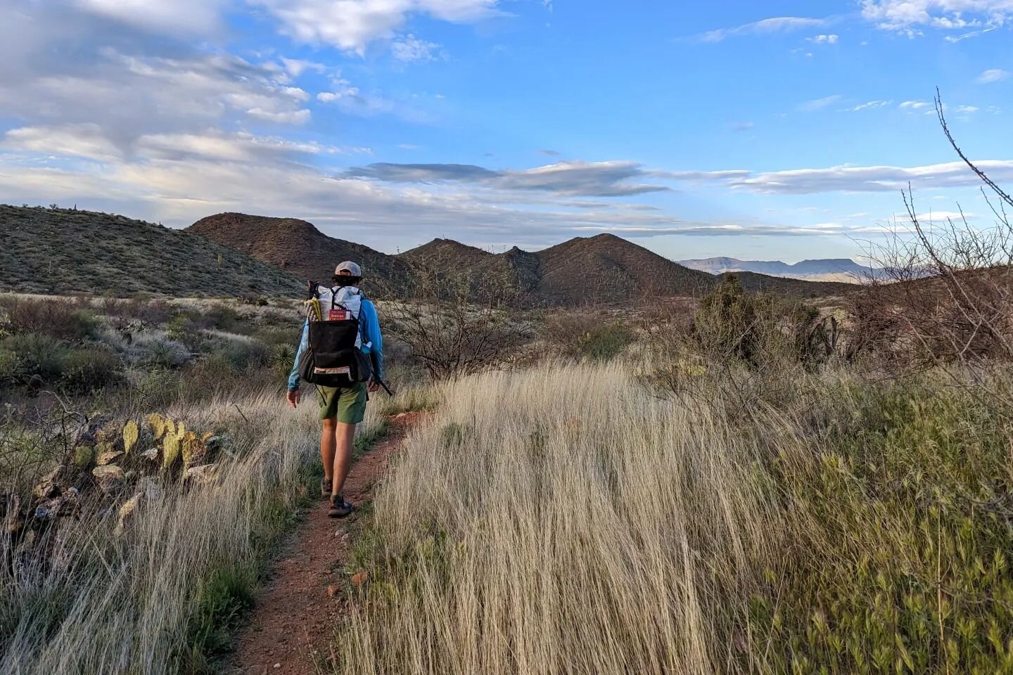
/The Wallowa Mountain Range, located in the Eagle Cap Wilderness of eastern Oregon, is one of the most stunning areas to backpack in the Pacific Northwest. Often referred to as the “Alps of Oregon”, the immense granite peaks of the Wallowas are best experienced on multi-day backpacking trips.
This 36-mile Wallowa River Loop Trail will take you over some breathtaking mountain passes and still ensure that you get a chance to take in the beauty of the Lakes Basin. Over the course of this loop you can expect to see crystal clear lakes and streams, wildflower-socked meadows, and granite peaks that will make you wonder if you’re still in Oregon.
There are also very worthy side trips to the summit of Eagle Cap and Matterhorn that will further solidify your appreciation of the Wallowas. Although this trail sees its fair share of hikers, we think it's well worth a visit.
QUICK FACTS
Distance: 36 miles
Days Needed: 4-5 days
Elevation gain: 7,500 feet
Best time to travel: July-September
Permits: free and available at trailhead
Difficulty: moderate-difficult
HIGHLIGHTS
Immense granite peaks
Pristine alpine lakes
Wildflower meadows
Beautiful glacier-carved valleys
Well marked and maintained trails
Permits are self-issued at trailhead and free
LOWLIGHTS
Little solitude, especially in the lakes basin
Seasonal bugs & snow
Some big climbs and descents
PERMITS
Permits for the Eagle Cap Wilderness are free and self-issued at trailheads.
BEST TIME TO TRAVEL
In general, late July to September is the best time to travel to this area. Snowpack is a key factor for trip planning in the Eagle Cap Wilderness. Some years a heavy winter snowpack and early season storms will keep trails covered into July. On warmer years with lighter snowpack, June backcountry trips are quite feasible. The same is true for autumn hiking, some years early snowstorms make this area inaccessible and other years it’s stable into October. You can always contact the local Ranger Station to ask about snow level and accessibility.
July and August are usually great for wildflowers, but that’s also the time when mosquitoes will be the worst. Use a combination of permethrin on your clothing and a small amount of 30% DEET on exposed skin for full protection. Mid-August through September can also be a good time to visit this area because crowds and bugs will be lessened.
Always pay close attention to the weather forecast before your trip and be prepared for changing conditions.
DIFFICULTY
Total distance: 36 miles
Total elevation gain: 7,500 feet
Overall difficulty: moderate to difficult
Difficulty depends on your experience, physical fitness, pack weight, & weather conditions. This is not a technically demanding hike, but there are a few big climbs and descents on this trail. Climbing over Polaris Pass is the most demanding portion of this hike with the trail on the west side of the pass being mostly scree. Be careful, go slow and watch your footing.
Hiking with lightweight equipment will help make this trip easier and more enjoyable. Check out my Gear Guide for my favorite backpacking equipment.
SOLITUDE
The Eagle Cap Wilderness is a popular hiking destination and the Wallowa River Loop is one of its more popular trails, so you shouldn’t expect to be alone on this hike. That said, we were surprised by how few other hikers we saw on the east side of Polaris Pass. Once we reached Glacier Lake and headed into the Lakes Basin, we started to see a lot more travelers.
To avoid the crowds, try to hike this trail mid-week and either before or after the summer rush from mid-July to mid-August.
ROUTE SUMMARY
The Wallowa River Loop can be completed in 4-5 days depending on your physical fitness level and desired pace. Because this hike is a true loop, you can hike it in either direction. Below is a general route summary heading in a clockwise direction. Before you hit the trail, make sure to consult a detailed map with trail numbers and milage. Also, make sure to consult your map at trail junctions because the signage can sometimes be a little confusing.
Begin your hike at the Wallowa Lake Trailhead, near the south end of the lake
Follow the East Fork Wallowa Trail until you reach Aneroid Lake. There are some good campsites along the lake.
Continue ascending up and over Tenderfoot Pass and onward to Polaris Pass, following signs for Polaris Trail. Take a moment to enjoy Polaris Pass. It’s arguably one of the best views in the Wallowas.
After the pass, descend through a well-graded, but long set of switchbacks and follow the trail to Frazier Lake.
At Frazier Lake, take trail towards Glacier Lake and Glacier Pass. There are some nice campsites close to Glacier Lake. Get ready for some stunning sunrises and sunsets as well.
After Glacier Pass you will begin descending down into the Lakes Basin Management Area. Follow signage heading towards Moccasin Lake.
You’ll then meet up with the Lakes Basin Trail, which will wind you through some stunning, crystal clear lakes and campsites.
The Lakes Basin trail eventually meets up with the West Fork Trail, which will lead you through beautiful Six Mile Meadows and back to the Wallowa Lake Trailhead.
MAPS & GUIDEBOOKS
Currently, there are only a few map options for this area, both of which are unideal for backpacking trails and milage. Imus Geographics and the U.S. Forest Service are the two options and they are often out of stock online. You can also look for the Imus Geo map at REI, but it’s often out of stock there as well. When we completed this loop, we stopped at the Ranger Station in Joseph to purchase a map.
Backpacking Oregon - This book is an excellent resource for the Wallowa River Loop and many other backpacking trips around Oregon. I highly recommend picking this book up if you like backpacking around the PNW. It’s got great play-by-play descriptions of this trail and is very useful when planning out camping locations and side trips.
Hiking Oregon’s Eagle Cap Wilderness - A practical, well-organized and thorough book about the various trails in the area complete with maps, trail descriptions, elevation profiles, and photos. This book contains information about backpacking trips as well as day hikes.
The Outbound Collective - A detailed description of this route, complete with trail numbers and mileage between sections.
Go Team Darley - A descriptive blog post on this loop with lots of good photos to get you excited.
REGULATIONS
Below is our summary of the regulations for this area. For the official regulations, please visit the USFS Wallowa-Whitman Recreation page.
Leave No Trace - If you pack it in, pack it out
No Motorized Equipment
No Bicycles
No Groups Larger Than 12
No Groups Larger than 6 if camping in the Lakes Basin Area
No Shortcutting Trails or Switchbacks
No Damaging Live Vegetation
No Entering Restoration Areas
No Camping Within 100 feet of any lake or posted wetland
No camp fires within 1/4 mile (1320 feet) of the following lakes: Bear Lake (Bear Creek Area), Blue Lake, Chimney Lake, Dollar Lake, Eagle Lake, Frazier Lake, Little Frazier Lake, Glacier, Hobo Lake, Ice Lake, Jewett Lake, Laverty Lake, Maxwell Lake, Mirror Lake, Moccasin Lake, Prospect Lake, Steamboat Lake, Sunshine Lake, Swamp Lake, Tombstone Lake, Traverse Lake, and Upper Lake.
WATER
Water is plentiful along this trail and is easily accessible from lakes and streams. Carry plenty of water to get from one source to the next and a lightweight water purifier. My current favorite is the Sawyer Squeeze and I highly recommend grabbing one for your trip.
BEARS & FOOD STORAGE
There are black bears in Wallowa-Whitman National Forest, however it’s not very common to see them along this route. Even if you don’t see any bears, there will still be plenty of smaller critters that will want to get into your food supply. And they’ll be happy to chew through your expensive backpacking gear to get after it. For that reason, food protection and storage are very important considerations in this area.
Make sure you know how to hang a bear bag properly or carry a food storage container. Bear canisters and Ursacks are the most effective storage methods and the easiest to use. There are no food storage requirements for this area, but you should always store your food properly in the backcountry.
SIDE TRIPS
If you have the energy and time, there are two incredible side trips off the Wallowa River Loop Trail that will reward you with panoramic views of the Eagle Cap Wilderness. The Matterhorn and Sacajawea Summits and Eagle Cap Summit trails will not disappoint.
TRAILHEADS
You will begin and end your trip at the Wallowa Lake Trailhead, which is located at the south end of Wallowa Lake. If you’re headed clockwise, you will begin your hike at the East Fork Trail, heading toward Aneroid Lake. If you begin counterclockwise, you will begin your hike on the West Fork Trail, heading toward Six Mile Meadows. This is a true loop, so you can go in either direction. However, some argue that climbing up Polaris Pass from the east can be more challenging, but is still totally doable.
GETTING THERE
It takes roughly six hours to reach the Wallowa Lake trailhead from Portland.
Driving Directions: From Portland, follow Interstate 84 East. Take exit 261 from I-84 E toward La Grande/Elgin. Continue to follow OR-82 East to Power House Rd in Wallowa County. You will arrive at Wallowa Lake Trailhead.
BACKPACKING GEAR
We prefer lightweight backpacking because it’s more comfortable and it allows us to cover more ground with less effort. For recommendations on our favorite lightweight backpacking equipment, check out the CleverHiker Gear Guide and Top Picks page.
WHAT TO PACK
TENT: We used the Zpacks Duplex tent on this trip. We love its combination of incredibly low weight and livability and that's why it's one of our top picks on our best lightweight backpacking tents list.
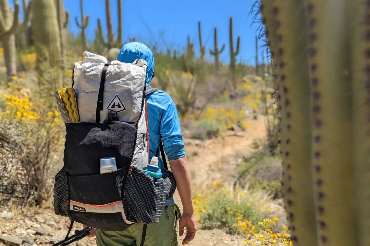
BACKPACK: We used Gossamer Gear Gorilla backpacks on this trek. They're lightweight, convenient, comfortable, and make our list of the best lightweight backpacking packs.
SLEEPING BAG: We used the Western Mountaineering UltraLite and Feathered Friends Swallow Nano 20 on this backpacking trip. They are both lightweight, incredibly warm, and make our list of the best backpacking sleeping bags.
SLEEPING PAD: We both used the Therm-a-Rest NeoAir XLite sleeping pad on this trip. It's light, comfortable, warm, and make our list of the best backpacking sleeping pads.
COOKING SYSTEM: We used the BRS Stove, Snow Peak Mini Solo Cookset, and Snow Peak Folding Spoon on this trek, all of which make our top picks gear list and best lightweight stove list.
WATER PURIFIER: We used the SteriPEN Ultra as our main purification method on this trip. It's lightweight, works fast, and doesn't require any pumping/squeezing or chemicals. Check out our best water purifiers list for our other top recommendations.
SHOES OR BOOTS: We wore Saucony Peregrine 7 trail runners (men's and women's) on this trail and they were excellent. If you prefer boots, make sure they’re lightweight and break them in really well before your trip. Here’s why we prefer hiking in trail running shoes: 5 Reasons to Ditch Your Hiking Boots.
HEADLAMP: A small headlamp like the Petzl Actik is an affordable, bright, and lightweight option.
FOOD: When backpacking the Wallowa River Trail you'll have to carry all your food. For some suggestions on common backpacking food options, check out our backpacking food video.
FOOD STORAGE: For this trip, we brought an Ursack, to keep the critters out of our food. There are no food storage requirements for this area, but you should always store your food properly in the backcountry. Bear canisters and Ursacks are the most effective storage methods and the easiest to use.
CLOTHING:
Here are some of our favorite hiking/backpacking clothing items from our Top Gear list.
1 Rain jacket shell - Patagonia M10 / Rab Kinetic Plus
1 Pair rain pants - Mountain Hardwear Stretch Ozonic
1 Down jacket - Patagonia Ultralight Down Hoody
1 Fleece jacket - Extra warmth under your down jacket that will be warmer when damp and better to hike in.
1 Pair hiking pants or running tights
1 Pair hiking shorts - Nike dri fit running shorts
1-2 Hiking t-shirts - Nike dri fit t-shirts
1 Long-sleeve shirt - Nike dri fit quarter zip
1-3 Pair underwear - ExOfficio boxer briefs or or ExOfficio women’s briefs
2-3 Pair socks (add thin sock liners if using boots) - Balega running socks for warm weather & SmartWool mountaineer socks for snow.
1 Pair long john bottoms - long john top optional for nighttime use.
1 Warm hat
1 Sun hat
1 Pair gloves or mittens
MAP & COMPASS: You should always hike with a topographical map. See above suggestins on map options for this area. In addition, we always hike with a compass.
FIRST AID KIT: Always bring a small personalized first aid kit. We used the .5 Ultralight Kit and added extras, like painkillers and personal medications.
SUN PROTECTION: Sunglasses (polarized recommended), sunscreen, and spf lip balm are an absolute must.
POCKET KNIFE: We brought along a small Swiss Army Knife, which came in handy here and there.
OTHER ITEMS:
SMALL TOWEL: the Nano pack towel is great.
CASH and ID
PERMITS
PERSONAL TOILETRIES
HAND SANITIZER: Always apply after using a bathroom and before eating.
WET WIPES: These can be useful for cleaning up after hiking.
INSECT REPELLANT: At higher elevations insects weren't a problem for us at all. For lower elevations, a 1oz bottle of DEET will do the trick.
CAMERA: The Sony RX100 is our go-to camera for lightweight backpacking.
WRAP UP & SLIDESHOW
I hope this guide helps you plan a trip along the Wallowa River Loop Trail. It’s one of our favorite places to backpack in the Pacific Northwest so we hope you will enjoy your trip and help preserve our beautiful wild spaces.
As always, please leave a comment below if you have any recommendations, questions, or suggestions. Thanks!
For more popular CleverHiker content, check out the following links:


Disclosure: Some of the links on this page are affiliate links, which means we may receive a small commission if purchases are made through those links. This adds no cost to our readers and helps us keep our site up and running. Our reputation is our most important asset, which is why we only provide completely honest and unbiased recommendations.